
Listen to this article
Estimated 4 minutes
The audio version of this article is generated by AI-based technology. Mispronunciations can occur. We are working with our partners to continually review and improve the results.
Satellites are constantly photographing Earth, and a new website designed by a University of Waterloo student is making these photos more accessible to the general public.
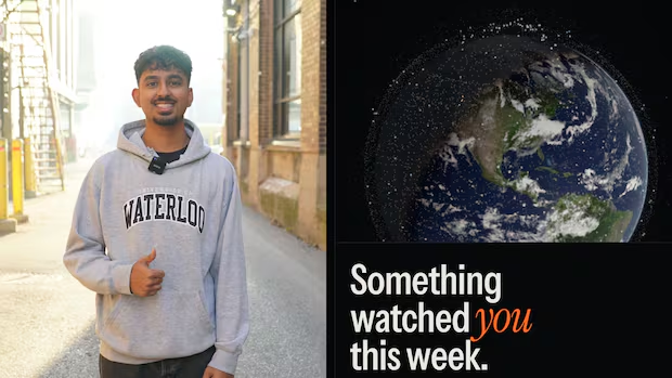
Armaan Gupta is a computer science student. As a project one weekend, he decided to make a website, Watched.Earth, when he found out some of his friends were unaware that satellites are perpetually taking pictures of Earth.
When a user clicks on the website they are greeted with an interactive globe. Users can type in an address and will be taken to that place on Earth. The website shows how many satellites passed by over the past seven days, and any publicly available satellite photos. There is also a “surprise me” option, which takes users to a random place on Earth.
A time-lapse feature shows photos from the past 10 years of a specific area. Gupta says the time-lapse feature helps highlight the scale of destruction in war-torn areas.
WATCH | UW student creates website that shows time-lapse satellite images:
UW student creates website that shows time-lapse satellite images
Armaan Gupta is a computer science student at the University of Waterloo. He recently created and launched the website Watched.Earth that shows publicly available satellite photos from anywhere on Earth, along with a 10-year timelapse of any location.
Gupta says seeing the progression of destruction in a war-torn area, such as Gaza, Ukraine or South Sudan can be eye-opening for people around the world.
“We always hear about these kinds of things, but it’s never really brought to our attention the scale of the destruction. Like, I can’t remember the last time it was made like so easily to see exactly how the shape of a particular war zone country has changed throughout the years,” Gupta said.

Watched.Earth shows how many satellites passed over an area within the last seven days, along with the recent publicly available photos taken by these satellites. (Watched.Earth)
Although all the photos on Gupta’s website are publicly available, he says compiling the photos from websites like NASA and other space agencies into one place makes them more accessible.
“I think that we should make it more accessible to the public that … like 6,000 satellites are taking images of you every few hours. And so I think that kind of information should be accessible to everyone,” said Gupta.
Not for professional analysis
Although the website is helpful for raising awareness about countries experiencing war, or just a spot for a curious person to go, the resolution of the photos are not clear enough for professional analysis, according to one expert.
Nathaniel Raymond is the executive director of the Humanitarian Research Lab at the Yale School of Public Health.
His team investigates war crimes and mass atrocities by analyzing satellite imagery, primarily from Google Earth and other high-resolution data sources.
Raymond says Watched.Earth allows the general public to access low-resolution imagery from one interface and “allows them to interact with it in a general way, but not to the degree you would if you were analyzing it to detect change.”
He says when using Watched.Earth, it can be difficult to make out alleyways between buildings or distinguish between structures.
However, the imagery that his team uses has a very high resolution that allows them to tell the difference between models of cars.
“In the case of Sudan, we can see dead bodies on the ground,” he said.
Despite the low resolution of most of the images on the website, Raymond says it is useful as an awareness-raising tool for the general public.
“It is important that platforms like this exist to allow members of the public to begin to gain familiarity with what can and cannot be seen at different resolutions, and to begin to understand how in conflict areas, damage happens over time at scale,” he said.

A photo of Gaza on the left taken by a satellite Dec. 8, 2015, as shown on Watched.Earth’s time-lapse feature. The photo on the right shows the same view of Gaza taken on Nov. 10, 2026. (Watched.Earth)
Gupta says he’s received a lot of feedback from users asking for higher resolution photos. He says he’s currently in the process of communicating with more satellite organizations to try and gain access to their data.
According to Raymond, higher resolution imagery is often highly access controlled, and isn’t updated as regularly as lower resolution satellites.