
Listen to this article
Estimated 2 minutes
The audio version of this article is generated by AI-based technology. Mispronunciations can occur. We are working with our partners to continually review and improve the results.
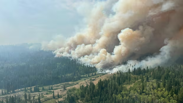
Officials have expanded evacuation orders related to British Columbia’s largest wildfire.
On Saturday, the Squamish-Lillooet Regional District expanded an evacuation order for an area south of the Pear Lake wildfire fire to cover properties near Highway 99 in the Marble Canyon area.
The Thompson-Nicola Regional District also expanded an evacuation order along Highway 99, west of the Highway 97 junction.
The expanded orders from both regional districts now cover nearly 200 properties in total.
Additionally, the Ts’kw’aylaxw First Nation has issued evacuation orders covering several of its reserves.
WATCH | Many B.C. wildfire evacuees cleared to return home:
Hundreds of B.C. wildfire evacuees given the go-ahead to return home
Residents of Clinton returned to their homes Saturday, though evacuation orders still remain in place for properties to the west of the village due to the Pear Lake Wildfire. Summerland residents are also gradually being allowed to return, but a boil water notice is in place for the district .
All three governments have also expanded evacuation alerts.
The Pear Lake wildfire has burned more than 1,647 square kilometres, according to the B.C. Wildfire Service, and is responsible for destroying structures on more than 120 properties, mostly in the area around Clinton.
The fire is currently most active on its western and southern boundaries.
As of Saturday afternoon, there were nearly 130 active wildfires across B.C., 45 of them classified as out of control.
On Friday, the B.C. government extended a provincial state of emergency related to wildfires until at least Aug. 29.