
Stephen Fai dreams of building another Canada.
What he envisions is not a replacement country but a parallel version of it online. His goal is to provide a repository for all manner of data on buildings, communities and landscapes, which can be updated to reflect changes in the real world. For those who create and manage physical spaces, it is a way of tracking what exists and experimenting with what could be.
Such a creation is known as a digital twin. The term was first coined by a NASA engineer in 2010 and has since been applied to a wide range of structures and systems.
But Dr. Fai, who directs the Carleton Immersive Media Studio at Carleton University in Ottawa, has long had something grander in mind. It’s a kind of virtual Canada that comes loaded with access to public information that users can combine with any new building project or management plan they choose to initiate.
Open this photo in gallery:
Dr. Fai holds a 3D-printed model that demonstrates how digitally assisted fabrication can aid in restoration of historic buildings, part of an earlier project involving renovations at Parliament Hill in Ottawa.Dave Chan/The Globe and Mail
Such a platform, he said, “can include representations of buildings and roads, but it can also include data from sensors, images from cameras, environmental information and census data – pretty much any kind of information that may be relevant to the problem you are trying to solve.”
This month marks a turning point in the effort to bring this idea to fruition. After years of development, Dr. Fai and his team have released the computer code that allows users to work with the platform, opening the door to what they hope will become a shared national resource.
To encourage its adoption, the team has also launched a not-for-profit organization, Collab Digital Twins, that serves as the entry point.
“What we’re anticipating is that some groups who are more tech savvy will download the application and start building on it,” Dr. Fai said. “Others may come to us and say, ‘Can you help us get this going?’”
The idea reflects an international trend. Around the world, data visualization is playing an increasingly important role in the nuts-and-bolts world of the building sector.
To understand the significance of this, it’s helpful to consider how much has changed since the days when information on buildings and other structures was only stored on paper, in the form of blueprints.
Open this photo in gallery:
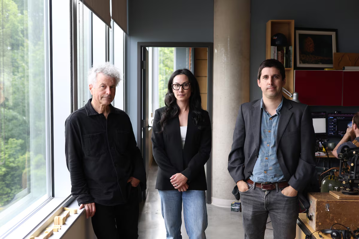
From left, Dr. Fai, CIMS associate director Lara Chow and Nicolas Arellano. With their digital twin project, the Carleton team is seeking to create a common format where users can combine their own proprietary projects together with public data associated with a given location.Dave Chan/The Globe and Mail
In the 1980s, computer software began taking over that job, making it possible to represent this information digitally – and to render plans in three dimensions to depict what buildings look like in real space.
More recently, such digital pictures have evolved into sophisticated entities called “building information models,” which carry deep knowledge about a structure’s specific features and functions.
The digital twin concept takes this one step further by connecting a model to streams of data flowing from its real-world counterpart. That way, as a building evolves and changes, so too does its digital twin.
Digital twins are already a feature of commercial software used by architects and builders. What the Carleton team has developed is a way for digital twins to co-exist on a shared platform rather than in separate universes. The platform is like a virtual canvas, which users can populate with their own assets and creations, allowing them to work together more easily.
Dr. Fai stressed that the goal is not to replace existing commercial tools with an exclusive new product but to build a common ground where commercial and open source tools can both be used.
Open this photo in gallery:
To encourage their platform’s adoption, Dr. Fai’s team has launched Collab Digital Twins, a not-for-profit organization that serves as the entry point.Dave Chan/The Globe and Mail
Commercial digital twin platforms typically come with hefty licensing fees, Dr. Fai said.
“That leaves out the majority of the people who design, construct, own and operate Canada’s built environment: small and medium enterprises, not-for-profits, rural municipalities, heritage institutions and Indigenous communities.”
As an alternative, the Carleton team sought to create a common format where users can combine their own proprietary projects together with public data associated with a given location. That could include geographic details, such as flooding or wildfire risk, or municipal data on things like housing and transportation.
“Imagine an architect working in Sudbury who wants to work on a project in Ottawa, but doesn’t have access to all of the data,” Dr. Fai said. “They could log into the twin, download zoning information, Statistics Canada information, and then upload their own model into that specific geospatial location.”
As the platform was taking shape, the Carleton team worked with the buildings of their own university campus as a proving ground. The results offer a concrete example of how a digital twin could be used by those who manage large public spaces.
In a proposal to the university’s facility, management and planning department, the team showed how the platform enables real-time monitoring of energy, water consumption, occupancy, parking, pedestrian and vehicular circulation, among other variables. It also provides a common reference to check if construction projects, at any scale, match the university’s master plan.
To keep information secure, each version or “instance” of the digital twin is unique to every user or group.
As the platform was taking shape, the Carleton team worked with the buildings of their own university campus as a proving ground. Here, a user flies into the team’s own offices to demonstrate how to access data including floorplan drawings associated with a workspace. Now that others can work with their platform, the team’s priority is to develop practical applications that demonstrate its value.
Carleton Immersive Media Studio
Lara Chow, the Carleton studio’s associate director, said this addresses another issue with relying on commercial software: It typically involves data storage that is not within Canada.
“What makes us different is that we’re a fully sovereign solution,” she said.
The Carleton studio, which Dr. Fai founded in 2007, has a history of working at the crossroads of architecture and digitalization. For example, in 2018, the group conducted detailed laser and optical scans of the Centre Block and library on Parliament Hill in Ottawa ahead of restoration work on those buildings.
The idea for a digital twin of Canada grew out of this work and other projects with various partners in both urban and rural settings. International efforts, particularly in Britain, which has its own national digital-twin program, also influenced the Carleton team’s vision.
In Canada, the group has received support from the National Research Council, through a program to improve innovation in the construction sector.
Farzad Jalaei, a research officer at the NRC and collaborator with the Carleton team, said that developing and releasing the platform is an important step “because it makes digitalization visible and testable, not just theoretical.”
The challenge, he said, is making digital tools and approaches attractive in a sector that has been traditionally resistant to change. Part of the issue is that owners are often not aware of the data they can have access to about their own properties or how to use it to optimize maintenance across the life cycle of a building.
Open this photo in gallery:
Dr. Fai holds a wood engraving of the Canadian flag, which served as a scale model of a much larger panel now installed at the Government Conference Centre in Ottawa, the temporary home of Canada’s Senate. The Carleton team worked with an architectural firm to transform the two-dimensional image of the flag into a three-dimensional relief carving that was produced with computer-controlled milling technology.Dave Chan/The Globe and Mail
A big test of the Carleton group’s effort will come in the next phase of their collaboration with the federal government when a version of the platform is set to be deployed by the Department of National Defence for keeping track of some 22,000 non-classified built assets across the country.
It’s a good start for showing the utility of the approach.
“You need to do some foundational things,” said John Hale, who leads digitalization efforts for the defence department, “and I think the Carleton platform really enables that.”
Mr. Hale is also president of the Canadian chapter of buildingSMART, a global organization that seeks to promote the adoption and standardization of digital methods in the building sector. Last year, the Carleton team’s platform won an international award from buildingSMART – a first for any Canadian group.
Now that others can work with the platform, the priority is to develop practical applications that demonstrate its value. Dr. Fai said many potential users both inside and outside Canada are looking at the platform. Some are outside the traditional building sector, such as epidemiologists who see the platform as a way to potentially model the spread of airborne infections through building HVAC systems.
Later this summer the team aims to release a more accessible visual demonstration of the platform so that people can see better how they may put it to use.
“It’s not just putting code out there, it’s creating an ecosystem,” said Nicolas Arellano, who is president of the not-for-profit, and whose PhD work at Carleton was based on developing the platform.
“We have a road map, a vision of how to make this something valuable for people,” he said. “But then this thing is going to evolve in ways that we have no way to predict, so that’s going to be interesting.”